Category: Uncategorized

Tips to follow in the Scan to BIM process to obtain perfect digital models

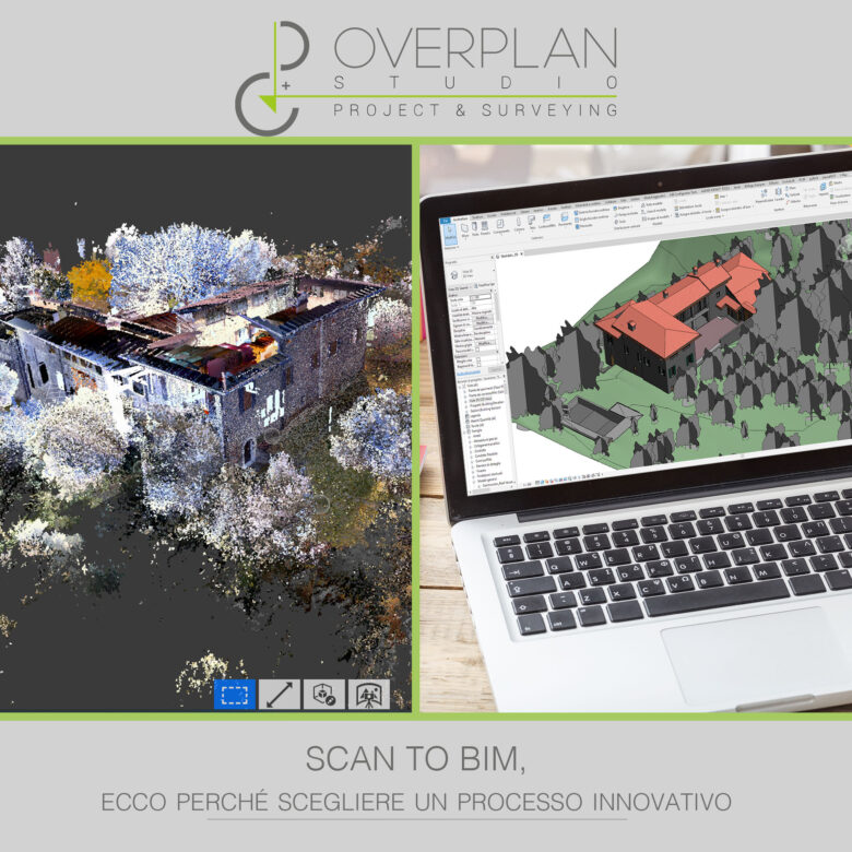
The Scan to BIM process allows you to use point clouds to develop a BIM model complete with all the information useful for the realization of the project.

After seeing the Scan to BIM phases, here are some tips to follow to obtain precise digital models that are suitable for the nature of the project.

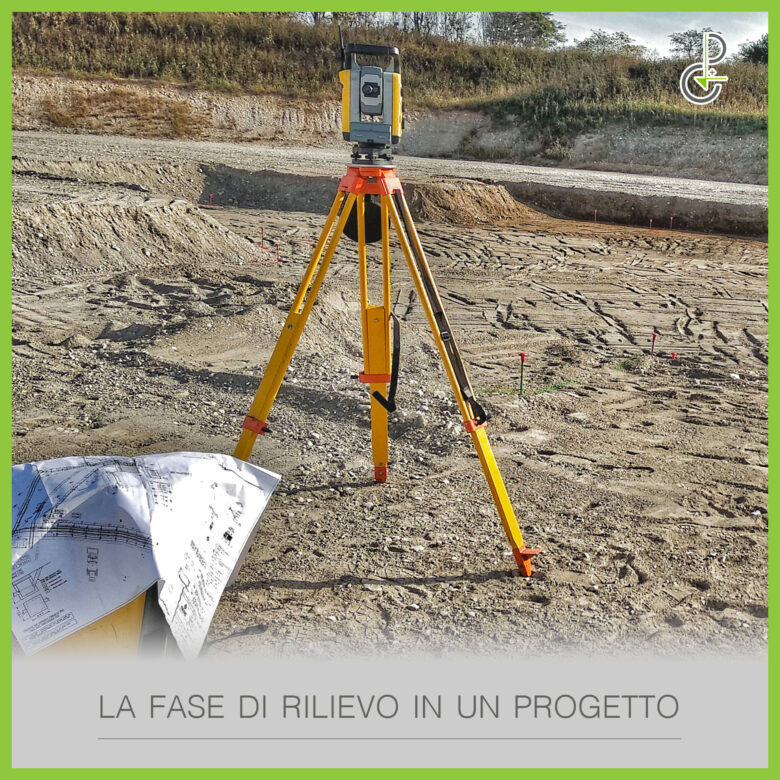
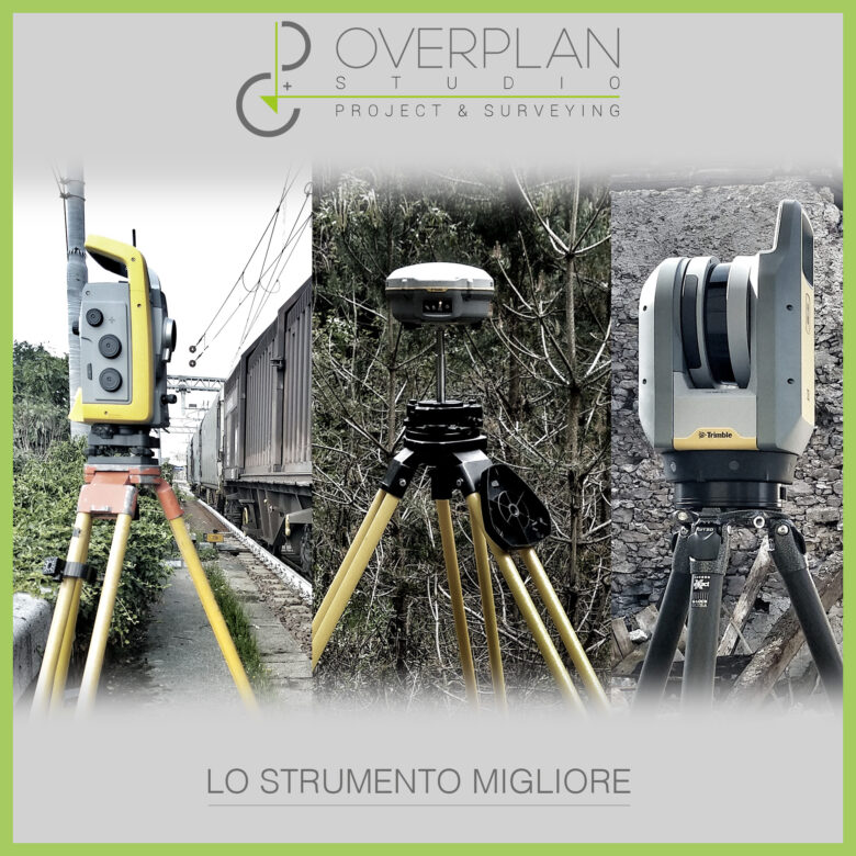
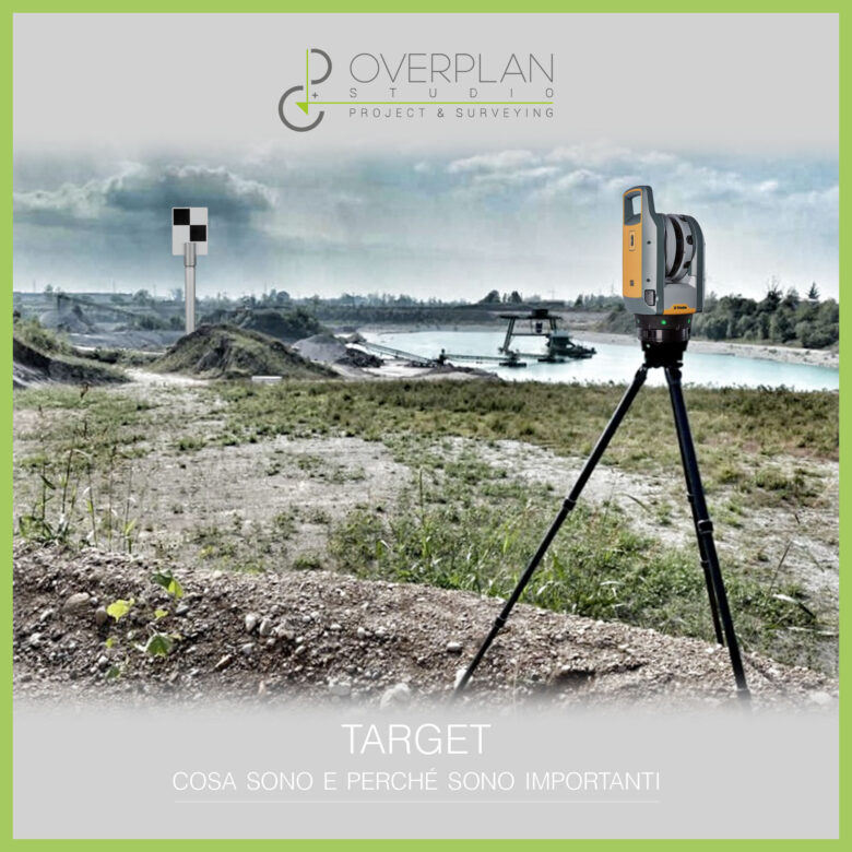
Carry out laser scanner surveying and point cloud processing with particular attention

To make a detailed BIM model, precise and rich in information is essential to create a good survey.

The laser scanner compared to traditional survey types, it has the advantage of being more precise, faster and more efficient, but the survey phase must be well organised and structured to avoid problems and errors.

Even the point cloud obtained should not be underestimated. In fact, after the survey, this should be modified and reworked, making it more accurate and precise and carefully selecting the information necessary for the project.

With a quality point cloud, the BIM Specialist who deals with the creation of the BIM model has all the tools to extrapolate the information he needs without the need for further surveys, thus saving time and money.

Having a correct Scan to BIM process management strategy

During modeling, in the Scan to BIM process the team makes numerous decisions that influence the outcome of the model.

These choices, consequently, also influence the work of architects, designers and companies who will carry out the project based on the BIM model.

For this reason it is essential to work with a action strategy which provides for maximum clarity. All decisions and choices made during modeling must be carefully studied and reported to become part of the BIM model user manual.

In this way the team's work is always tracked and a complete and detailed database, which facilitates the use of the model for all the professional figures who will work on it subsequently.

Choosing the correct LOD for your project

A BIM model It does not need to be filled with all the data and information related to the construction, simply those necessary for the realization of the project are sufficient.

For this reason, in the Scan to BIM process it is necessary to choose the right LOD for the model, that is, the level of definition or detail.

The LOD indicates the level of detail with which the elements must be represented within the BIM model.

It is useful for Enter only the necessary information in the form to the project and to make the work more streamlined and efficient and limit the possibility of errors.

In any case the ideal is never overdo the details, otherwise you will waste time and end up with a heavy and slow model.

In most cases, it is sufficient to accurately report:

  • The shape of objects;
  • Their size;
  • Their position in space.

If the objects are particularly elaborate in their shapes and dimensions, to avoid weighing down the project it is better to work with advanced modeling tools, to reproduce them within the model in an accurate but simple and light way.

How to make a good survey: a phase that is still too underestimated

There survey phase in a project is fundamental, but even today it is too often underestimated. This is why it is important to be precise in this phase and how to make an accurate survey.

The entire design of a building is based on the survey phase

Too often, to save time and money or due to excessive trust in the tools at one's disposal, one tends to carry out the survey phase without due precision and accuracy.

However, the survey phase is a fundamental one, because it is on it that all the subsequent design and construction phases are based. It is precisely in this phase that the biggest mistakes are made, which can compromise the progress of the work, even causing the Construction site closure.

Survey and building permit

Carrying out a good survey is important not only to avoid errors in the design and to make the work smoother and more efficient. It is also important, above all, to get bonuses and tax deductions.

The relief is a representation of the actual state of the places where the work will be carried out. If this does not correspond to reality, due to inaccuracies and errors in the survey, it can lead toinvalidation of the building permit, the fundamental administrative practice for carrying out the works.

This is a significant damage, both because it slows down the works, but also and above all because the building permit is needed to obtain tax deductions and save on the cost of worksInvalidating it means having to give up this type of bonus.

To avoid all this, How to make a good topographic survey, with safe and precise results?

How to make a correct architectural survey

The first thing to do is to choose the most suitable tools for surveying. Each survey has its most suitable instrumentation, but the advice is to choose instruments equipped with the latest technologies such as surveying with drones and laser scanners.

This type of technology is more precise and allows to obtain cleaner point clouds, simpler to extrapolate and convert into error-free BIM models

Eliminate problems before the survey

Another fundamental element for a good survey is reduce the possibility of errors avoiding the common problems during a surveyTo do this, we start from an accurate analysis of the territory and its characteristics, to define a correct action strategy.

Seeing relief as an investment

Finally, as we have specified several times, a well done relief is not a simple cost as is often thought, but an investment. The risk of losing access to tax deductions is concrete proof of this.

Surveys, especially those using new technologies such as laser scanners, have their costs, whether they are made accurately or roughly.

The cost of laser scanner survey it doesn't change depending on the quality point clouds obtained from the survey, for this reason the advice is take full advantage of the investment to achieve an accurate and precise survey, although this choice inevitably requires more time to implement.

CAD vs BIM: Why Choose Scan to BIM as an Innovative Process

The Scan to BIM It is considered an innovative process, but what are the advantages compared to CAD restitution? Let's see the differences CAD vs BIM and let's make a comparison between the different survey techniques.

CAD vs BIM: The Differences

We can consider BIM as an evolution of CAD, but not only. The CAD model is a graphic representation of the project or parts of it, while the BIM model digitally returns the entire project.

With BIM and the Scan to BIM process it therefore changes the point of view on design, which is no longer a simple graphic representation but a working methodology.

Not only that, on a technical level the BIM It is integrated with the technology of the laser scanner survey, while the CAD it ties in with the traditional survey with total station.

Processes compared: laser scanner survey and traditional survey

Both laser scanning and traditional surveying have their own advantages and disadvantages, which is why we often wonder what the best survey method.

The traditional relief Compared to the laser scanner, it is faster in graphic restitution, but it presents several problems:

  • Requires longer times of note;
  • It leads more easily to incorrect or inaccurate results;
  • Generate a limited amount of information and requires more surveys to be able to integrate them;
  • It involves at least two people to carry out the survey;
  • The representation of the actual state in CAD is limited to the information obtained;
  • It does not allow designers to have a complete vision to start working.

The laser scanner survey On the other hand, it is slower in graphic restitution, because it is necessary to work on the obtained point cloud, but it has numerous advantages compared to traditional surveying:

  • Speed up the process under construction;
  • It is performed by one person only;
  • Gets more detailed information and precise, without the need to repeat the measurements;
  • Limits the possibility of errors and inaccuracies;
  • It integrates with the Scan to BIM process;
  • It allows designers to have a complete picture of the work to be done, with all the information needed to start the process.

The advantages of Scan to BIM compared to CAD restitution

The laser scanner integrated into BIM is a innovative process which allows you to obtain a greater amount of information and more precise data.

Compared to the CAD return, Scan to BIM:

  • He has a more complete database of data and allows you to know all the information about the building;
  • It allows you to work by sharing information in real time with other team members;
  • Optimize timing, costs and work management;
  • Improve the safety on construction site;
  • It offers a complete vision of the work to be done at each stage, from design to facility management.

BIM compared to CAD restitution is a most modern and innovative technology, but this does not mean that CAD should be completely demonized.

There CAD return It allows you to share and modify projects more easily and quickly and to detect any problems such as misalignments more easily than with parametric software.

What is topographic surveying and how is it done?

The topographic survey It is a fundamental measurement that every surveyor must know how to perform at his best. Let's see what it is, how it works and what its objectives and tools are to achieve it.

Definition of topographic survey

The topographic survey allows you to graphically represent a building and the environment that surrounds it, through the measuring precise data to obtain and report on paper or digitally the shape, slope and position of the elements present in the area to be surveyed.

This is a indirect relief, in which complex calculations and processing must be carried out to take measurements, and allows for measure and manage via software angles, oblique distances and differences in level.

We can distinguish two main types of topographic surveys:

  • Altimetric, in which the differences in height with respect to the reference surface are calculated by measuring them with physical quantities;
  • Planimetric, in which the position of specific points on the ground is calculated by measuring angles and distances.

The objectives

This type of relief is fundamental for the representation of the territory and has as its main objectives:

  • Collect detailed information to realize cartographic representations or score points on the earth's surface;
  • Analyze the territory, find reference elements and draw boundaries to carry out studies for the design and construction of a new building;
  • Realize cadastral maps or representations of an existing territory or building.

The tools to use

The main one instrument to carry out complete topographic surveys is the total station, born from the union of optical theodolite and electronic distance meter, two technologies that allowed respectively measure angles and distances.

The total station instrument works with two different technologies:

  • Infrared rays, which require a reflective prism to perform extremely precise surveys;
  • Laser beams, which allow you to detect points even in hard-to-reach environments.

Together with the total station, instruments such as GPS and GNSS, and to achieve a more precise, accurate and faster survey, the instrumentation for the is often used in synergy laser scanner survey.

The phases of the survey beyond the survey itself

Obviously when we talk about topographic surveys it does not simply mean the executive phase, but as for any other type of survey, reference is also made to the preparation phase of the survey and to the subsequent phases, that is, to the graphic reproduction of the work and the resulting works.

In preparation phase topographic surveys are important know the territory, by carrying out an inspection on the site of the survey to understand the action strategy, but above all it is necessary to pay particular attention to the related documents, for example cadastral maps, surveys and maps of the area.

This first phase is as fundamental as the survey phase itself, as the creation of a precise and accurate topographic survey is fundamental for the subsequent phases of the works, first of all those of the tracking surveys.

The tracing surveys are carried out on site and allow for the execution of a detailed design activity, ensuring that all elements of the project are in line with the plans and that they are all placed in the right position.

The steps to follow for an error-free Scan to BIM process

The Scan to BIM allows you to extrapolate from the point cloud a 3D BIM model accurate and optimized design of the building. From preparation to data restitution, let's see which are the phases of Scan to BIM to follow to create a efficient, complete and error-free digital model.

The four phases of the Scan to BIM process

In recent years the laser scanner surveys have always become more precise, accurate and faster, in particular thanks to the new instruments equipped with all the technologies to best carry out even the most complicated surveys.

However, the tools alone are not enough to produce quality surveys, on the contrary, there are some steps to follow meticulously to consider the work complete and well done.

In the Scan to BIM process you can recognize four main phases, closely linked to each other, through which to create a complete and precise work. Here are what they are.

Preparation of the survey

In the pre-acquisition phase it is important to carry out all those procedures that allow for avoid problems during scanning, which:

  • Make ain-depth analysis to outline the best action strategy;
  • Choose the instrumentation most suitable for making the relief;
  • Select the places from which to scan;
  • Calibrate and carefully position laser scanners and target.

Detection and actual scanning

There acquisition phase It is the main phase of the Scan to BIM process and is carried out with the laser scanner, but very often these technologies can be integrated with the topographic survey, to make the scan more precise and accurate.

At the end of the laser scanner survey one or more images are obtained point clouds, to be processed and modified in the next data processing phase.

Data processing and point cloud editing

After scanning the obtained data is processed in specific editing software of point clouds.

At this stage we are working on the point cloud even before extrapolating it. For example, you can:

  • Assign coordinates for align the point cloud and insert it into real space;
  • Select only the necessary information, thus lightening the point cloud;
  • To derive some mesh from specific parts of the cloud.

It is important to remember when editing the use to be made of the point cloud, only in this way can you clean and modify the file by filtering only the necessary points and selecting only the information useful to the project.

In this way a light point cloud and free of useless data.

Data return and creation of the digital model

After making all the necessary changes you can move on to the final stage of the work, that is the restitution of the data with the extrapolation of the point cloud and the creation of the digital model.

In the Scan to BIM process, from the point cloud you can extract a 3D BIM model complete with all the information necessary for the realization of the project and for the management of all the phases of its life.

Editing the point cloud during data processing makes it easier to choose the appropriate one. Level of definition of the BIM model, allowing you to select only the information necessary for the project and the model itself.

How to choose the best tools for laser scanner surveying?

We know it well by now, each relief is different from the other. For this reason it is unthinkable to have only one type of laser scanner surveying tools and it is necessary to equip oneself with different instruments based on the type of survey to be carried out.

Let's see what they are types of instrumentation and what are the characteristics to take into consideration when making your choice.

Types of 3D laser scanner tools

Before specifying the characteristics on which to base the choice of instrumentation for the laser scanner surveys, let's see what they are main types of existing instruments.

1. Mobile or terrestrial

THE 3D laser scanner they can be either mobile That terrestriThe first ones are easier to use, faster and more flexible, ideal for making quick scans where excessive precision is not necessary.

Use the Earth models requires instead more experience and more acquisition time, but from the scans you get more precise data, high-resolution images and more detailed point clouds.

2. Camera scanner or Panorama scanner

THE Camera scanner They are 3D laser scanners ideal for carrying out surveys of remotely located surfaces, while the models of Laser Scanner Panorama They are ideal for detailed and precise scans, for example of interiors or complex and detailed architectural structures.

3. With internal or external digital camera

The internal digital cameras often have a low resolution, for this reason they are generally preferred scanner with externally mounted camera and integrated into the acquisition software.

Features to consider in laser scanner surveying tools

1. Type of measurement and maximum measurement distance

These are the two fundamental elements in the choice of instruments for laser scanner surveying. The measurement types are divided into:

  • Optical triangulation, to scan small objects with high resolution and up to 25 meters away;
  • Phase difference, to scan larger objects at a distance of 2 up to 80 meters;
  • Flight time, to scan very large objects positioned from 2 meters away up to 6 km.

It is important to remember that the more the instrument reaches a range wide, or a greater distance, the lower the resolution of the acquisition will be.

2. Acquisition speed

There speed It is an important feature of a tool for the laser scanner survey, because it allows you to reduce scanning time and costs. This can range from a few seconds to a few minutes and depends on several factors, including:

  • Measurement type and distance of the object;
  • Speed of systems instrument mechanics;
  • Angular step and field of view of acquisition.

3. Precision and accuracy

There precision is a typical characteristic of an instrument. It is its ability, under the same stresses and measurement conditions, to provide the same response several times. Theaccuracy Instead it concerns the measurement and is the difference between the real value and the measured value.

It is not always necessary to have a precise and millimetre-accurate tool. In the case of environmental surveys, for example, great accuracy is not necessary, while it is essential in the survey of internal areas of a building.

4. Integrated software type

In addition to the features mentioned, it is important to ensure that the tools have quality acquisition software, equipped with all the features needed to carry out a precise and accurate survey, including ease of use, presence of automations and scan preview.

5. Weight and resistance

Last but not least, it is essential to take into account the weightor of the instruments and their resistance to impacts, because they very often have to be transported manually and moved, especially when surveying problem areas.

The advantages of the integrated survey in the Scan to BIM process

The use in synergy of BIM with laser scanner survey techniques has brought numerous benefits to the AEC industry. The Scan to BIM process can be further improved thanks to the integrated survey techniques, let's see what the advantages are for surveys and the creation of point clouds.

The topographic surveys

To carry out any type of project, be it the construction of a new building or the renovation of a pre-existing construction, the starting point for doing a good job is the knowledge of the territory and the site where the building is located.

This is possible through the topographic surveys, to be created with the most suitable technologies based on the type of site you have in front of you.

Over the years, the technologies available to us for topographic surveys have multiplied, becoming ever more more precise and efficient, and today it is possible to carry out surveys using for example:

  • GPS measuring systems;
  • Total stations;
  • Photogrammetry;
  • Drones for aerial surveys;
  • Laser scanner 3D.

In recent years, important technologies have been added the synergic use of BIM, which gave rise to the process Scan to BIM and brought numerous Benefits to the AEC Industry.

What are integrated survey techniques?

BIM was born as a methodology for the construction of new projects and buildings, but more and more often it comes also used to obtain a digital model of existing buildings, particularly historic buildings and those of high architectural value.

For this reason we often have in front of us particularly difficult surveys to carry out and which can create numerous problems, in particular in the case of:

  • Complex or large buildings;
  • Internal and external areas of the building;
  • Historic buildings with unique architectural shapes;
  • Constructions in difficult areas or with complicated logistics, etc.

The best solution in these cases is to use the integrated relief, or the synergistic use of more techniques and instruments for surveying, to obtain more precise data acquisition and have a coordinated workflow.

The advantages of using integrated survey techniques and Scan to BIM

Using integrated survey techniques has numerous advantages and is considered one of the best methods for carrying out surveys for projects of historical and architectural importance.

Working with integrated relief:

  • Makes the workflow more efficient and faster;
  • Reduces the margin of error;
  • It allows you to reduce time and costs;
  • It provides more data and information for the Creating more accurate point clouds.

About point clouds, the integrated reliefs simplify the process of creation and joining also thanks to thesynergistic use of different solutions and software for their extraction.

Using multiple interconnected software allows you to:

  • Increase the productivity;
  • Have more check on the data;
  • Check already on site the accuracy and quality of scans to immediately optimize the point cloud; 
  • Working on the point cloud already in the pipeline, eliminating unnecessary data and overlapping scans to make it lighter, easier to share and Start the Scan to BIM process to obtain a digital As Built model of the building.

Why integrate virtual reality into design?

Take advantage of the Virtual Reality in the design is one of the latest frontiers of the AEC sector. Here are the advantages for designers and which technologies to associate with BIM and virtual reality.

What is Virtual Reality?

There virtual reality, also known as RV or VR, is a digital simulation of reality, created on the computer and to be explored through the use of systems such as visors, which make theimmersive experience.

How BIM and Virtual Reality Connect

We can consider virtual reality as a natural evolution of BIM.

The 3D model proposed by BIM is in fact a digitization of the real building, which can be:

  • Viewed and navigated via PC, tablet or smartphone;
  • Explored in virtual reality through a headset.

The new frontiers of virtual reality in design and BIM

Today technology is making great strides even in the AEC sector and virtual reality can be integrated with other immersive technologies available to designers, for example:

  • Collaborative virtual tools such as virtual studios, which allow all figures involved in the project to work and present 3D models in the same virtual environment in real time;
  • Immersive software to coordinate work at every stage of the project lifecycle, creating optimized workflows;
  • Technologies and software from the world of video games, like the serious game, which bring gamification to the construction world and thus allow for improved processes and also for immersive and effective training;
  • Metaverse, in which physical people are transported thanks to the use of avatars and can work simultaneously and in real time with multiple software, improving collaborative processes.

Why Virtual Reality is Useful for Designers

Thanks to virtual reality and new technologies it is possible create an immersive experience, useful for both clients and end customers, who thus have a more realistic idea of the work right from the design stage, which for the designers themselves.

Using virtual reality in design offers numerous benefits to designers, which from the early stages of conception can:

  • Integrate information between BIM and Virtual Reality, thus being able to read all the information relating to the project through the individual objects;
  • Know every detail about the building and on its internal structures;
  • Explore the building in 1:1 scale;
  • Have all the information about the building in real time, to plan and manage work;
  • Identify, report and correct defects and errors;
  • Anticipate possible changes and implement them from the very first moments;
  • Working in a single environment with other figures involved in the project, improving communication and coordination;
  • See in preview what the building will look like once finished;
  • Improve your workflow and cure every detail at its best.

In addition to all these advantages, there are also:

  • Benefits related to the maintenance of the work, programmable already in the design phase;
  • A best customer approach, to whom the virtual work completed in every detail can be shown from the very first stages, to manage any changes right from the design stage and offer the customer a more complete experience.

How many and what are the dimensions of BIM?

We know What is BIM? and what are its advantages, but how are the different information managed within it? Let's see what are the BIM dimensions and how they are used within a project.

What are BIM dimensions

When talking about dimensions, in an architectural project one thinks about the graphic representation of the work, that is, 2D and 3D, dimensions relative to the geometry of the work.

However, we know that within a BIM project there is not only geometric information, but also information relating to each phase of the project's life, from its conception to its dismantling.

This leads to the existence of new dimensions, the BIM dimensions, containers of additional information on every aspect of the project, essential for the correct construction and management of the work.

What are the 7 dimensions of BIM

BIM dimensions are governed by the UNI 11337 standards, which recognize seven dimensions, from 3D to 7D.

BIM 3D: Three-dimensional modeling

Thanks to the 3D dimension of BIM you get a three-dimensional model of the work, completely similar to the real building and containing all the information relating to its geometry.

Having a 3D model of the work allows you to visualize the project even before its actual realization and offers the possibility of intervening in advance with any changes.   

BIM 4D: Timings

The BIM 4D it is related to the planning and managing project timelines. Having all the information on the timing is essential for:

  • Improve communication between team members;
  • Anticipate potential problems;
  • Reduce errors.

In this way, work is optimised and effectively manages every phase of the project.

BIM 5D: Costs and quantities

With the BIM 5D it is possible to do a detailed analysis of costs and quantity takeoff, the quantification of the specific costs of each process included in the project, for example:

  • Materials;
  • Amount;
  • Labor.

This size allows you to:

  • Monitor and control costs even in case of changes;
  • Manage project work more effectively;
  • Automate cost calculation.

BIM 6D: Management

The 6D it is related to the Facility Management of the project, or the management of the work in every phase of its life.

Provides information regarding items such as:

  • Plants;
  • Component status;
  • Technical specifications;
  • Guarantees;
  • Maintenance manuals, etc.

This allows for a complete and efficient management of the work, with a particular focus on error reduction, cost reduction and more sustainable choices for the project. 

BIM 7D: Sustainability

Speaking of sustainability, the BIM 7D It focuses on the information relating to the sustainability of the work, in the field:

  • Environmental;
  • Economic;
  • Social.

It allows you to create estimates of the energy consumption of the work, in order to reduce them and make the project sustainable.

Three new dimensions: 8D, 9D and 10D

In addition to those just mentioned, today we are talking about new dimensions, ranging from 8D to 10D, which are not yet standardized.

BIM 8D: Safety

The BIM 8D adds all the information relating to the seven dimensions project safety.

Contains information relating to the construction site management, For prevent risky situations and ensure the safety of all those involved in the construction of the work.

BIM 9D: Lean Construction

Through the BIM 9D it is possible digitize processes, making work easier and more streamlined. It allows you to:

  • Optimize or eliminate non-value-adding activities;
  • Automate processes;
  • Working in a perspective Client-driven BIM.

This is to save time and costs and work more effectively at every stage of the project.

BIM 10D: Industrialization of the AEC Sector

The BIM 10D It encompasses the common goal of the remaining nine dimensions, namely industrialize and make the construction sector more productive, optimizing every phase of the work's life.

This is possible through the new technologies, which allow you to centralize data and obtain a complete vision of the project, integrating data relating to the financial, commercial, environmental, safety, risk analysis sectors, etc.

What are targets and why are they important in a laser scanner survey?

A good one laser scanner survey cannot rely only on quality equipment. In fact, it is necessary to start from a strategic planning of all the phases of the survey, which also includes the positioning of laser scanner tools and targets.

What are targets in a laser scanner survey and what are they used for?

What are laser scanner targets?

THE laser scanner targets or markers They are accessories that support the survey instrumentation, which allow the scan to be recorded and carried out more efficiently, acting as reference points on the territory.

They are used in particular in laser scanner scans of external areas and ensure high precision, especially when it comes to merge the results of multiple scans.

The targets must be:

  • Highly visible from the laser scanner;
  • Easily adaptable to the characteristics of the terrain;
  • Easy to place and to remove.

There are two types of targets:

  • Naturals, or particular elements that are easily recognizable during scanning such as edges or doors;
  • Artificial, reflective accessories at the wavelength of the laser scanner. Artificial targets

There are different types of artificial laser scanner targets, let's see what they are.

1. Flat or paper targets

These are the Most used targets, typically square but also circular in shape, and are placed on the ground or fixed to a surface. They are made with two colors arranged in a checkerboard pattern to be visible to scanners and are the cheaper, especially paper ones that can be printed.

The important thing when printing paper targets is do not use an inkjet printer, otherwise there is a risk that the laser will not see the different colors and will make an inaccurate scan.

2. Spherical targets

Spherical laser scanner markers are the more practical to use, because their shape makes them easier to position and makes scanning more effective from any direction.

Generally they are painted with a specific reflective white paint and can be equipped with either a support or a magnetic base, which is more modern and practical. 

3. Targets marked with ID

THE target with ID They can be either flat, paper-based or spherical and are equipped with different and unique numbers and matrices.

Having targets marked with an ID allows you to work more easily even in particular situations, as in the presence of several geometrically similar elements (columns, windows, etc.), or in narrow spaces.

In fact, IDs allow the point clouds obtained from different scans of hook up with each other to obtain a complete survey and point cloud of the necessary data.

How to use targets and markers for laser scanner surveying

Laser markers allow you to create points that are easily recognized by the laser scanner. Using them takes longer to scan, but simplifies data acquisition and allows for faster and more efficient registration work.

It is important though know how to use these accessories to perform correct scans.

  • First of all it is important to buy or make them in specific materials, neither shiny nor transparent, and above all position the targets correctly, which may otherwise lead to an incorrect scan of the territory.
  • Each area to be scanned also has specific characteristics and for this reason they must be use different techniques, the advice is therefore to have multiple types of laser scanner markers and targets available during a survey to be able to use the best ones in every situation.
en_GBEnglish